Turf, fertiliser, seed and wetting agent are all sold by the square metre, and most people guess the size of their lawn. Ten minutes with a tape, or a traced map, takes the guessing out of every order and every spreader setting.
How do you measure a lawn by hand?
Split it into shapes you can work out:
| Shape | Formula | Example |
|---|---|---|
| Rectangle | Length × width | 15 m × 12 m = 180 m² |
| Triangle | ½ × base × height | ½ × 8 m × 6 m = 24 m² |
| Circle | 3.14 × radius² | 3.14 × 3 m × 3 m = 28 m² |
Front and backyard are separate areas, and so is the nature strip if you look after it.
What about curves, garden beds and trees?
Draw a rectangle over a curved section and take off the part that is garden bed or path. Take off paving, the clothesline area if it is bare, and mulched rings around trees. Round to the nearest square metre.
How much turf and fertiliser then?
For turf, order your area plus about 5 percent for cuts and curves. For fertiliser, seed, lime and wetting agent, multiply the area by the rate on the pack. The fertiliser calculation with NPK is in How Much Lawn Fertiliser Do You Need?
Which measuring tools make it easier?
A 30 m fibreglass tape does most backyards in a few minutes, with a second person holding the end. A measuring wheel is quicker for big blocks and long nature strips, and a laser distance measure works well against a fence or wall. Whatever you use, write each number straight onto the sketch so you do not measure the same side twice.
How does measuring on a satellite map work?
You trace the lawn on an aerial photo, point by point, and the app works out the area. It is quick for odd shapes and easy to redo when you add a garden bed.
The example lawn in the app is a Sydney backyard drawn as one area:
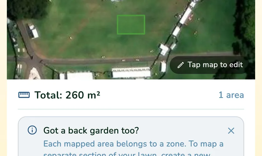
In What a Green Lawn you tap the map to place corners and drag them to adjust. The area updates as you go, in square metres and square feet. Front and backyard go in as separate zones, and the total drives the product amounts on the dashboard. Trees, shade sails and shadows can hide the edge on the photo, so check one side with a tape.
How accurate does it need to be?
Within 5 to 10 percent is fine. Being far off is what costs you: a turf order short by 30 m² means a second delivery, and a fertiliser dose worked out on a lawn half its real size burns it. Measure once, write it down, and measure again when you change the garden.
What a Green Lawn keeps the mapped area with your lawn and turns it into product amounts, so you measure once and skip the maths at the spreader.